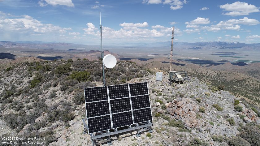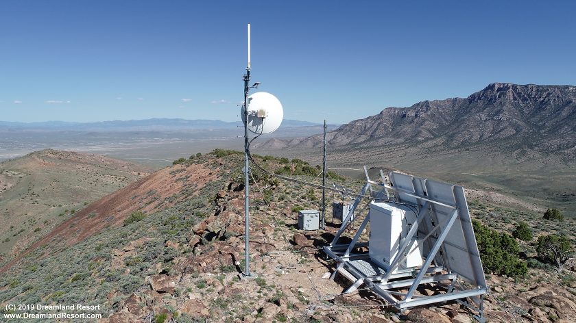
This article discusses the equipment used in the Nevada Test and Training Range (NTTR) during Red Flag and other air exercises that provides instructors and ground controllers a 3-D picture of the simulated air combat, including air-air engagements and air-ground strikes in real time. The system involves state of the art sensors on the aircraft and a network of ground stations that, like an inverted GPS system, triangulate the 3D position of an equipped aircraft. The ground stations are connected to each other and to the control center at Nellis AFB via microwave links. The data is recorded and can be played back in the debriefing after each sortie for training purposes.
The original system, set up around 1985, was called Air Combat Maneuvering Instrumentation (ACMI). Initially it covered a relatively small part of the southern 60's Ranges. The ACMI system was replaced by a system called RFMDS (Red Flag Measurement and Debriefing System), which allowed an increased range by using newer, more powerful hardware. In 1998 the RFMDS in turn was replaced by NACTS (Nellis Air Combat Training System), which increased precision and range as well as the amount of available data and supported aircraft. The first generation of NACTS, like its predecessors, still used a proprietary microwave link network between the ground stations. The NACTS system was upgraded again around Fall of 2013 to the more powerful P5 Combat Training System (P5CTS), which today is used in several USAF and Navy training ranges. Instead of a properietary data link between the ground stations and the backbone P5CTS uses standard IP based microwave relays to tie into the Nellis Digital Microwave Communication System (NDMCS). As of this writing in February of 2024 the P5CTS system with 15 networked ground stations is in use in the NTTR. 4th generation jets are outfitted with pods near the wingtips that facilitate data download. 5th and 6th generation aircraft have integrated systems. The P5CTS system can handle 600 aircraft simultaneously. All systems were developed by Cubic Defense Systems.
The backbone of the NDMCS includes Ella Mountain, Highland Peak, Mount Irish, Cedar Peak, a microwave relay site just south-east of Tolicha Peak, Angel Peak and finally Nellis AFB. All sites are connected via microwave links.
The telemetry downlink frequencies (air-ground) in the NTTR are 1819.0 MHz for the Blue Team and 1845.0 MHz for the Red Team. ACTS systems in training ranges across the United States all operate in the 1755-1850 MHz band. Due to reallocation of part of that band for commercial use the system may soon be moved to the 2025-2110 MHz band.


The AIS Pod and Downlink systems:
The AIS pod is the most important piece of equipment, providing the flight data downlink from all aircraft to the ground. Each aircraft participating in the exercise is equipped with an AIS pod. AIS or Airborne Instrumentation Sub-system is the link between the controllers at Nellis AFB and the individual aircraft carrying the pod. Each pod carries a number of high-tech sensors, which gather and transmit to the ground all relevant flight data, such as exact location, altitude, speed and many other flight parameters.
Each AIS Pod includes Air Data sensors with Pitot Tube, Radar or Radio altimeter, Dipole Antenna for UHF, Signal conditioner, Transponder, Power supply, Digital Processing unit, Inertial Sensor Assembly, Digital Interface.
Inertial Navigation System (INS):
This is equipped with a radio/radar altimeter for ultra accurate altitude measurement at low level over rough terrain. It also has its own Pitot tube to measure air speed, altitude and other data.
Transponder:
This is located inside the body of the AIS pod and receives radio signals from the various ground stations around the ranges. It receives the signals then transmits them back to the ground station, together with the Pods collection of data including altitude, speed and attitude of the aircraft. The delay between the original signal and the signal transmitted back from the aircraft is measured by the ground stations. Acting like an inverted GPS system it allows a very accurate 3D triangulation fix on the aircrafts location, accurate to 15ft or better.
Data collected by the AIS pod and sent to the CCS includes:
Speed, Altitude, Attitude, current G-Forces, Ascent/Descent Rate, Turn rate, Yaw rate, Roll rate, Engine power, Missile cue, Rocket cue, Gun cue, Bomb cue. Plus Weapons release points which also shows the controller the range, trail, heading etc of each weapon such as an air-air kill with a missile. Successful kills, Unsuccessful kills and if the pilot has been shot down (which in an exercise usually sends the pilot into a timeout, before he can re-join the action)
All this data is collected and decoded at the Control and Computation System (CCS). The CCS sends the data to a 3-D display in the control room, called Display and Debrief System (DDS). The DDS gives the controllers and commanders an accurate, real-time picture of the air war and the status of each individual aircraft. From here controllers can virtually sit in the cockpit of the aircraft and see what the pilot is seeing and doing on the so-called Simplified Head Up Display (SHUD).
Aircraft are identified by the number of the AIS pod. The SHUD shows controllers and pilots during debriefing how each pilot performed in the simulated air combat. In the SHUD controllers can also see other aircraft, Red or Orange for the Opposing Red Forces and Blue for the friendly Blue Forces. Each missile fired is shown by a computer-generated trail so the controllers can visually track the missile.
Ground receivers:
The NACTS system includes about 15 ground-based receivers located inside the range or around its perimeter. These receivers transmit the data via microwave link to a few backbone sites, where the data is gathered and transmitted to the CCS via microwave link or fiber optic cable. The backbone sites include Cedar Peak in the north, Ella Mountain in the east and Angel Peak in the south.
Ground Threat Simulators:
The NTTR Ranges also include extremely realistic Threat Simulator Sites. Each site simulates a particular weapon system such as an Early Warning Radar Site, SAM sites, AAA sites etc. The sites can either be a real threat using Russian made equipment or American made simulators using the Bands and wave lengths of the Russian systems. The threats include so-called 'Smokey SAMs', a simulated Surface to Air Missile site that launches rockets producing a smoke trail like a Real SAM. The simulated SAMs are fired at the incoming aircraft of the opposing force.
Simulated Targets:
The Ranges further include convoys of armored vehicles with one over 15 miles long, incorporating every type of vehicle the allies would come across. The simulated targets are mostly located in the northern (70's) ranges. The Range also includes mock airfields such as the 'Korean Airfield' located at Tolicha Peak Electronic Combat Range (TPECR), complete with various scrapped aircraft. These airfields are used for live and practice air attacks using guns, rockets and bombs. There are also mock cities and industrial complexes built out of shipping containers, various types of bunkers and trains, including a fully mobile train on an extensive network of railroad tracks for use in strafing and bombing exercises.
Each air-ground attack or strike is viewed by high resolution cameras on the range that track each aircraft and provide detailed video and still photos of the release of weapon, descent and impact. This material is used later in the debriefing at Nellis to show how accurate the strike was and to discuss tactics and improvements.