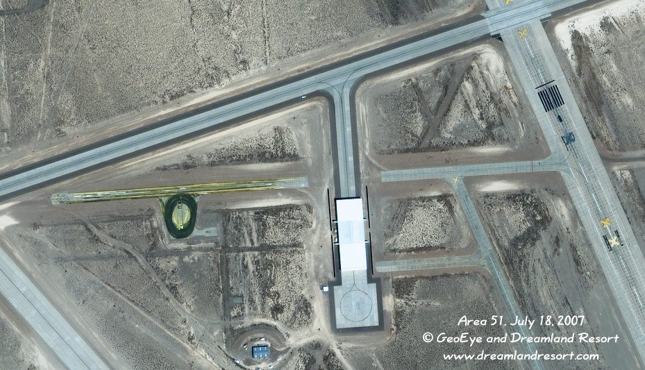
This frame shows the northern and southern extension of Hangar 19, and the screens east and west of the hangar. It also shows, as expected, a new turn-around pad south of the hangar, which is only accessible from the north now.
The runway markings of the old runway 14/32 have been painted over. The runway is marked as closed in its full length with yellow X-es. The yellow-greenish tracks on the left section of the old center taxiway are new. Not sure what this is. Possibly this area was used to test the paint used for marking the runways and taxiways, or the machines used to apply it.
Satellite image taken by the IKONOS-2 satellite on Wednesday, July 18, 2007 at 11.43am PDT. © 2007 GeoEye and Dreamland Resort. Publication outside of the Dreamland Resort web site is strictly prohibited.