Message posted by Joerg (Webmaster) on August 29, 2016 at 9:29:46 PST:
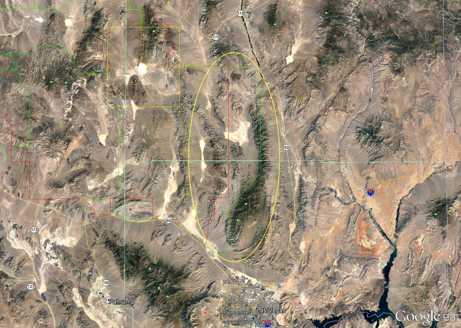
I have received additional confirmation that the planned 300,000+ acre Air Force land grab will be the land around Alamo Road. The area between the red and green outline in the attached picture, circled in yellow. The Red outline is the current border of the NTTR, the green outline is the border of Range 61-65. Apparently the land grab will align the restricted area to the Range boundaries. That will not only close Alamo Road from US-95 to Alamo, but it will also close the main access road to Tikaboo. There is a second road that will still be open, but last time I traveled it, years ago, it was quite rough.
In Reply to: Another land grab? posted by Joerg (Webmaster) on August 26, 2016 at 16:45:17 PST:
Replies: